
Join us on

Please visit the Sitemap to see the full range of information on this site
MountainWalk.co.uk is produced by Trish Haill Associates Copyright
Have you climbed Ben Nevis, Snowdon or Scafell Pike? Or taken part in the Three Peaks Challenge? Or have a special walk you'd like to share? We'd love to here from you! Join us on Facebook or Send us an email.
Ordnance Survey Active Map Review
Fed up of soggy maps disintegrating in the wind and raing? So are we! So when MountainWalk was asked by Ordnance Survey to trial their new 'Active' map range we jumped at the chance. Ady Gray - a regular contributor to the site - had discovered his was lacking a map, so what better than to ask him to trial the Active Waterproof Map for us?
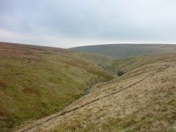
Ogden Clough
As the great man - Alfred Wainwright - put it all who truly love Lakeland are exiles when away from it. That is my fate. I am exiled. I am exiled by my job. However, it could be worse.
At least they sent me to Darwen. Darwen? Thats what I said. Situated south of Blackburn and north of Bolton, Darwen is another of those East Lancs ex-mill towns like Accrington and Bury, situated in an area that once produced 85% of the cotton manufactured worldwide. Fortunately for me, Darwen sits just below the stunning Ribble Valley and the Forest of Bowland AONB (Area of Outstanding Natural Beauty) and just on the rim of the West Pennine moors. Exile is bearable then.
So, I moved and what was the first thing I did when I got settled? Yes, I tramped over the moors for the view from Darwen Tower. Built, ostensibly, in 1898 to celebrate Queen Victorias Diamond Jubilee, Darwen Tower is significantly more important to walkers than it royal connection. Some 30 years before the mass trespass to Kinder Scout, Darriners fought a long and hard battle to stop the Reverend Duckworth blocking their ancient right of access to the moors. Typically for the age, Duckworth was an absentee landlord and his main interest was in the game shooting on the moor. Supported, and led by William Ashton a local coal mine owner, the local people won their twenty year battle in the courts and gained access for all to some wonderful moorland with views over to Manchester and the Fylde Coast on a good day.
So far so good for me in my new home. But it was then that I spotted a gap in my Ordnance Survey map coverage of the area. OL41, Forest of Bowland and Ribblesdale was missing. Fate stepped in and Trish, who runs this site, sent me a link for a review copy from the OS website. Perfect. I ordered the Active copy and it arrived promptly in two days. Now, when you buy an OS map, you get four choices: Landranger - at 1:50,000 - or Explorer - at 1:25,000 with both coming in Standard or Active versions. As a hiker/walker, youll want the Explorer range for the greater detail. That is, in my opinion, a given. Your big choice is Standard or Active. £7:99 or £13.99, the difference in price is reflected in the properties of the map with the Active benefitting from a weatherproof coating.
Is that worth the extra £6? Yes, I believe, after using one extensively, that it is. Although the Active version is both bulkier in your pack - it doesnt fold as flat and is slightly heavier - the coating both protects the map from the elements and makes it easier to use in windy conditions as it is stiffer than the Standard version. Lets face it, we live in the UK: it rains. It rains a lot. Reading a map, a skill we should ALL have, even though outdoor GPS devices are getting more and more common. I use a Garmin myself - but it is difficult in some conditions.
Having stood atop Fairfield in The Lakes, searching for the right path off to Great Rigg (which is confusing in ideal conditions) in high winds with a Standard map that began to disintegrate due to rain and the force of the wind, I now heartily recommend upgrading to the Active range.
Putting the extra bulk and weight aside, which is actually negligible (and you can always shave the difference off elsewhere) the Active OS map is easier to use and, with that weatherproof coating, routes can be drawn on before departure and wiped off on return using a suitable marker. I used Garmins Basecamp program to determine my route on the day.
I reviewed OS Explorer OL41 to study the area in a 3D profile and then simply drew it on the map and set off for Clitheroe bound for, that 'almost-a-mountain' icon of the area, Pendle Hill. Pendle Hill falls some 170 feet short of being classified as a mountain but still maintains a prominent position in the list of major summits due to its geography - it gives stunning views of Bowland AONB and Ribblesdale - and its history - the legend of the Pendle Witches. It is also generally quite windy on the top and, as my walk was in January, I was expecting some rain. I was pleasantly surprised. The rain didnt materialise but it was very windy and a cold mist hung. That weatherproof coating got a good workout. It stood up to the test with aplomb.
The walk I took that day is laid out on the site here but, it suffice to say that, all my maps are now, and will continue to be, Active ones.
I never leave home without a map, even though my Garmin is amazing, and neither should you. My only quibble with the OL41 which covers the Forest of Bowland and Ribblesdale is an omission by Ordnance Survey of the location of Robin Hoods Well on the summit of Pendle Hill. My e-mail has already gone off to Ordnance Survey and maybe, when a revision is due, it will feature. The Grid Reference is 805420, locate the summit of Pendle Hill - known as Big End or Beacon - on the map and look slightly north to find the number 42, marked by OS to remind you which northing box you are in, and there you will find the well that George Fox, the founder of the Quaker movement, is said to have been drinking from when he wrote in his journal that as I went down, I found a spring of water in the side of the hill, with which I refreshed myself, having eaten or drunk but little for several days before. This was the time of his great vision on the hill in 1652 when, at the height of their persecution, Fox determined to lead the Quakers to America.
So, there you have it: a great map and a bit of a history lesson thrown in for free. OS maps are available here at the Ordnance Survey Shop. Youre still faced with the four choices but I hope this article will help you decide that the Active Waterproof map may cost you a little more to start with, but you'll find it will last much longer than the traditional paper copy, and has the benefit you can draw and redraw different walks on it.
You might also be interested in:
How to Use a Map and Compass
Hiking Equipment Reviews by Ady Gray
Guide for Buying Walking Boots
Equipment Review - Merrell Walking Boots
Why use Walking Poles and Which to Buy
Good Rucksacks for Walking
Maps, Compasses and Other Useful Items
Wet Weather Wear - Waterproofs
Why should you buy a GPS
Winter Walking Equipment